
At a glance
Hushe Valley at a glance
- Where
- Last village of Ghanche District, Gilgit-Baltistan, on the Hushe river above the Shyok.
- Village elevation
- About 3,180 m (10,420 ft) — roughly 950 m above Skardu.
- From Katpana
- About 100 km paved to Khaplu, then an unpaved jeep track. Budget a full day each way.
- Vehicle
- 4x4 required above Khaplu. A saloon car will not finish the drive.
- Season
- Roughly June to September. Snow and meltwater close or damage the track either side.
- Population
- 931 at the 1994 census — the most recent published figure we can find.
- Language
- Balti, with Urdu.
- Gives access to
- Masherbrum (7,821 m), K6 (7,282 m), K7 (6,934 m), Laila Peak (6,096 m), Charakusa, Nangma and the Gondogoro La.
- Fuel, ATM, pharmacy
- None above Khaplu. Fill the tank in Khaplu, and properly in Skardu.
- Where to sleep
- Basic village guesthouses and camping. Most non-trekkers stage from Skardu or Khaplu.
01
Where Hushe actually is, and why "last village" is literal
Ghanche District, the Shyok, and the point the road stops.
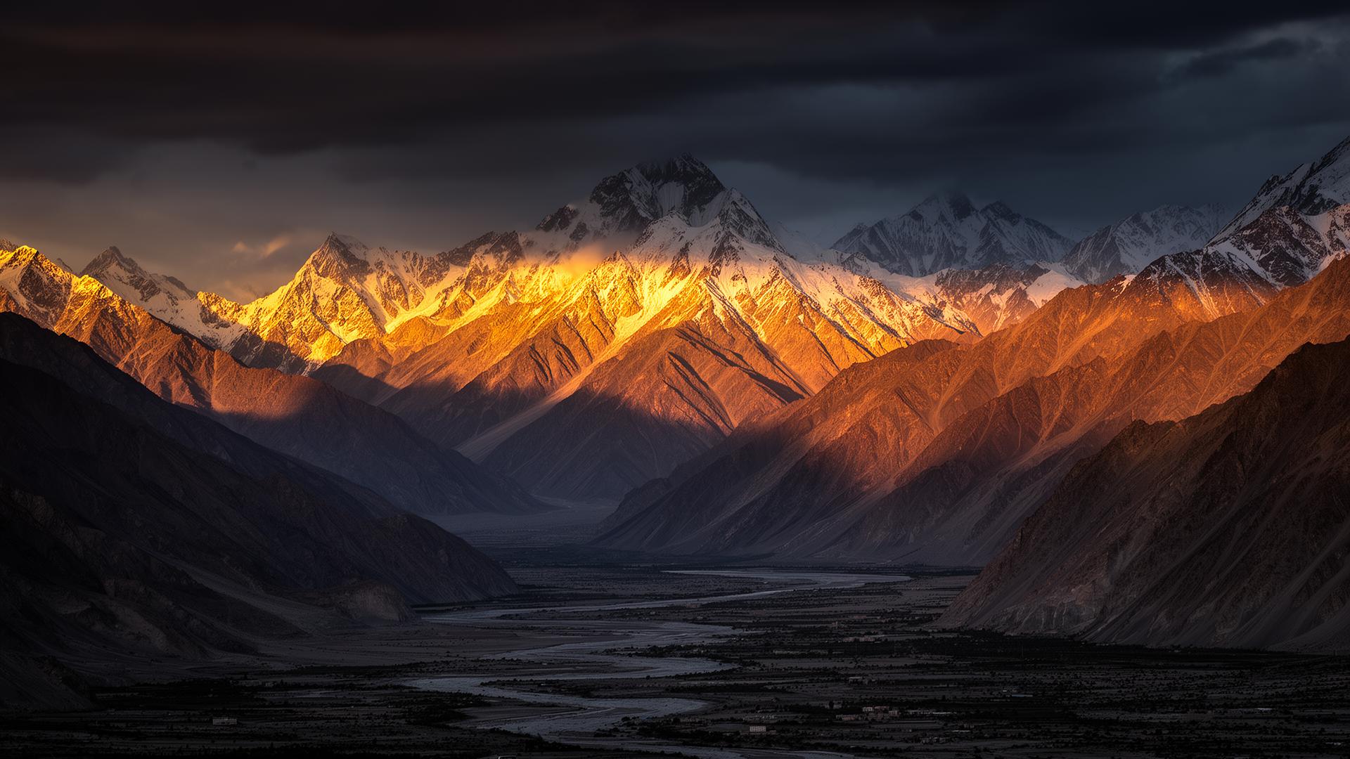
The Hushe Valley runs north off the Shyok in Ghanche District — the easternmost of Baltistan's districts, with Khaplu as its headquarters, 8,531 square kilometres of it and 157,822 people at the 2023 census. The Hushe river drains south into the Shyok and then the Indus, so the water that passes the village ends up passing Skardu.
The village sits at about 3,180 metres — 10,420 feet — roughly 950 metres above our garden in Katpana. That gain matters more than the distance does, and we will come back to it.
What makes Hushe different from the other side valleys around Skardu is that it is the end of something rather than a stop on the way to something. North of the village there is no onward road, only the Masherbrum and Gondogoro glaciers and the paths expedition porters have walked since the 1960s. Climbers coming down from Concordia and K2 over the Gondogoro Pass rejoin Pakistan's road network here, having walked for a fortnight to do it.
02
The drive from Skardu: a hundred kilometres of asphalt, then the track
The journey splits in two, and people underestimate the second half.
The first part is the Khaplu road, east along the Shyok. Paved, genuinely beautiful, and about three hours for our drivers in normal conditions. It needs no jeep.
The second part turns north off the Shyok road beyond Khaplu. It is shorter in kilometres and takes most of the remaining day: unpaved in its upper section, crossing meltwater channels that run hardest in the afternoon, and needing a 4x4 with clearance. Published figures for the whole Skardu–Hushe journey run from about 140 to 150 kilometres and six to eight hours; operators quoting the low end are describing a dry morning with no stops. We tell guests to budget a full day each way and to leave Skardu early, so the water crossings are done before the sun has been on the glaciers all afternoon.
Two notes we give every guest. There is no fuel between Khaplu and the road end, so fill in Khaplu. And there is no live road-status service for Gilgit-Baltistan — only somebody who drove it yesterday, which on this track means a driver in Khaplu rather than anything on the internet.
If the pattern sounds familiar, Basho Valley works the same way: paved to a bridge, then a jeep track. Hushe is the same idea at three times the length.
03
What Hushe Valley is the gateway to
Four things lead out of the valley, and they are why it has a name outside Baltistan.
Hushe's reputation is borrowed from what sits above it. The village itself is small and working; the mountains at the head of the valley are among the best known in the Karakoram.
Masherbrum — the peak that was K1
Masherbrum stands at 7,821 metres, the 22nd highest mountain in the world and the ninth highest in Pakistan, and it is what you are looking at from the village. It was the first peak the Great Trigonometrical Survey mapped in the Karakoram, which is why Thomas Montgomerie labelled it K1 in 1856 — K2 was simply the next one along behind it. It was first climbed in 1960 by George Bell and Willi Unsoeld, with the Pakistani climber Jawed Akhter summiting two days later.
Charakusa — K6, K7 and the granite
The Charakusa Glacier at the head of the valley is the one climbers talk about. K6 rises to 7,282 metres above it and K7 to 6,934 metres, the latter first climbed in 1985 by a Japanese team with base camp on the Charakusa. The valley's reputation among alpinists is disproportionate to its size, and parties come for the quality of the granite rather than for altitude.
Nangma, above Kanday — the big-wall valley
Nangma, reached from Kanday lower down the valley, is the one a non-climber can most easily enjoy: a short, steep side valley of meadows under vertical granite, walkable in a long day from the road, which Charakusa is not.
Gondogoro La — the crossing to Concordia
The Gondogoro Pass sits at 5,585 metres and links the Gondogoro Glacier on the Hushe side to the Vigne Glacier and Concordia on the Baltoro side. It is why trekkers finish in Hushe rather than walking back out the way they came. It is not a walk: crampons, steep snow with slopes up to 50 degrees, and up to around 300 metres of fixed rope on the southwest side, maintained through the season by local climbers. It is generally easier earlier, from roughly the last days of June, and deteriorates as the snow cover melts away.
04
Season: when Hushe actually works
A summer valley with a narrower window than Skardu's.
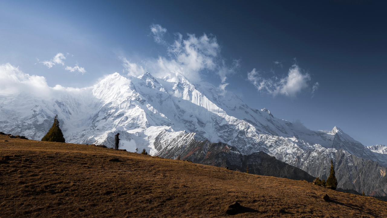
Roughly June to September is usable. In spring the track is damaged or blocked by meltwater and the high ground is still under snow; by October the nights at 3,180 metres are hard and the valley winds down for a winter in which the road is not a tourist proposition at all. July and August are the climbing and trekking months, when the village has a working economy of porters, cooks and guesthouses rather than a few families.
One timing detail worth planning around: the Gondogoro crossing is at its best at the front of the season, from late June, while the jeep track is most reliable a few weeks later once the first flush of melt has passed. Those two do not perfectly coincide.
Altitude is the other half. Hushe is 950 metres above Skardu, and most guests reached Skardu by air from near sea level a day or two earlier. Getting from Islamabad to a guesthouse at 3,180 metres inside 48 hours is how people spend their Hushe night with a headache. The sequence that works is unglamorous: two nights in Skardu, a low day in between, then Hushe.
05
Permits, guides and what the rules actually say
Most visitors to the village need nothing. Above 6,000 metres is a different regime.
Pakistan's trekking regulations define trekking as travel on foot up to 6,000 metres, and treks in designated open zones are walked by foreigners without a permit or a mandatory guide. A drive to the road end and a walk up Nangma sits comfortably inside that.
Restricted-zone routes are a different regime: a permit applied for through the tourism division and an approved guide, with a government liaison officer accompanying parties on unspecified restricted treks at the party's cost. Above 6,000 metres it stops being trekking and becomes mountaineering, with its own permit and royalty structure.
We deliberately publish no fee table for any of this. The figures move, they are quoted inconsistently across operator sites, and we have no first-hand basis for them — we book rooms and drivers, not expeditions. We will tell you which category your plan falls into and point you at people in Khaplu and Skardu who do this for a living. Foreign nationals should confirm their own entry requirements for Gilgit-Baltistan separately; that is a visa question, not a trekking one, and it changes.
06
Where to sleep, and why most guests stage from Skardu
Village guesthouses are for trekkers. Everyone else keeps a base.
Hushe has basic village guesthouses and camping ground, used in high season mainly by expedition parties. They are what they sound like: simple rooms, simple food, intermittent power, no heating worth the name. For a trekker about to spend a fortnight on a glacier that is perfectly adequate and part of the experience. For everybody else it is not the trip they pictured.
The pattern that works for most of our guests is to keep a base in Skardu — heated room, reliable hot water, generator-backed power through the valley's load-shedding, a kitchen that runs — and treat Hushe as a two-night excursion, breaking the journey with a night in Khaplu, which has proper hotels and earns a half day of its own for Khaplu Palace and the Chaqchan mosque.
We are at Katpana on the western edge of Skardu: sixteen rooms, about ten minutes from Skardu International Airport, breakfast from six so anyone leaving for the Khaplu road is moving before the day warms. We can arrange a 4x4 and a driver who has actually run the Hushe track, and we will hold the room while you are up the valley rather than making you pack everything out.
Sixteen rooms at Katpana, breakfast from six, and a 4x4 with a driver who has run the Hushe track this season.
See the rooms and rates07
What to pack, and what Hushe does not have
Pack for 3,180 metres, not for Skardu.
Nights in the village are cold in midsummer, and the difference between a Skardu evening and a Hushe evening is a real layer: an insulated jacket rather than a fleece, a hat, shoes that cope with dust and water, sunglasses and sunscreen for a sun that is fierce even when the air is not.
What the valley does not have is the part people forget. No fuel above Khaplu, no ATM, no pharmacy, no reliable mobile data — SCOM is the only network with real presence in Baltistan and even that thins as the valley narrows. Carry more rupees than you expect to need, bring prescription medication, and bring a power bank. For Hushe, add a layer to the usual Skardu list and subtract any assumption that you can buy something on the way.
Getting around
The Hushe road from Katpana, stage by stage
Times are what our own drivers take in normal summer conditions, not a map estimate. Meltwater, roadworks and a slow vehicle in front add to every one of them.
| Place | Approx. travel time | Why go |
|---|---|---|
| Khaplu | About 3 hours | Paved the whole way, along the Shyok. The last town with fuel, a bazaar and a proper hotel. |
| Machulu | 4–5 hours | Where the valley narrows and the road surface starts to change. |
| Kanday, for the Nangma valley | 5–6 hours | The trailhead village for Nangma, the big-wall side valley a non-climber can walk into. |
| Hushe village | A full day; 6–8 hours is the honest range | Road end at about 3,180 m. Everything above here is on foot. |
Guest feedback
What guests actually say
We don't publish a star score of our own, because the only ratings worth reading are the ones we can't edit. Reviews for Arcadian Resort Skardu live on the booking platforms below, written by guests who paid for their rooms. Read them there, including the critical ones.
Location
Where Arcadian Resort actually is
Arcadian Hotel & ResortKatpana Road, Katpana, Skardu 15100
Gilgit-Baltistan, Pakistan 15100
0310 0973119
Arcadian Resort sits in Katpana, on the quiet side of Skardu: roughly ten minutes from Skardu Airport, ten minutes from the Katpana cold desert dunes, and fifteen to twenty minutes from the bazaar and Kharpocho Fort.
How we know this
Drive times, road surfaces and the practical sequencing of a Hushe trip come from our own drivers and from guests reporting back, which is why they are written as ranges rather than fixed figures. Elevations, peak heights, census figures and the regulatory position come from the published sources listed below and are attributed rather than presented as our own observation. Where no authority publishes a figure — the condition of the jeep track in any given week is the clearest case — we say so instead of inventing one. We publish no permit or royalty fees, because we do not arrange expeditions and have no first-hand basis for them.
Reviewed: Each summer, and whenever the Khaplu road or the Hushe jeep track changes condition.
Written and checked by the team that runs the house in Katpana, Skardu — the people who watch the Deosai road open and close, book the drivers, and answer the phone at midnight. Our editorial standards.
Sources
Where the figures come from
- Hushe — Wikipedia ↗
- Source for the village elevation of 3,180 m (10,420 ft), the 1994 census population of 931, Balti and Urdu, the porter economy from the 1960s, and the Central Karakoram National Park office.
- Hushe Valley — Gilgit-Baltistan Tourism Department ↗
- Source for "the last village of the Ghangche District", the sub-valleys, and Murtaza Peak at 5,100 m.
- Ghanche District — Wikipedia ↗
- Source for Khaplu as district headquarters, the 8,531 km² area and the 2023 census population of 157,822.
- Masherbrum — Wikipedia ↗
- Source for 7,821 m, 22nd highest in the world, the K1 survey designation of 1856 and the 1960 first ascent.
- K6 — Wikipedia ↗
- Source for 7,282 m and the Charakusa Glacier at the head of the Hushe valley.
- K7, first ascent — American Alpine Journal ↗
- Source for 6,934 m, base camp on the Charakusa Glacier, and the 1985 first ascent.
- Laila Peak (Hushe Valley) — Wikipedia ↗
- Source for 6,096 m and the peak's position near the Gondogoro Glacier.
- Gondogoro Pass — Wikipedia ↗
- Source for 5,585 m, the Gondogoro–Vigne glacier link, the late-June window and the fixed ropes.
- Trekking rules in Pakistan ↗
- Source for the 6,000 m definition of trekking, open versus restricted zones, and the guide and liaison-officer requirements.
Questions
Questions we get asked about Hushe Valley
Published figures run from about 140 to 150 kilometres, but kilometres are the wrong unit. It is roughly a hundred kilometres of paved road east to Khaplu — about three hours for our drivers — then an unpaved jeep track north up the Hushe valley that takes most of the rest of the day. Six to eight hours one way is the honest range, and we tell guests to budget a full day each way rather than a number of hours.
Rooms & prices →Come for the road end, not for a photograph
Hushe is where Baltistan stops being a place you drive through. There is a last village, a glacier above it, a 7,821-metre mountain behind that, and a path over a pass to Concordia people have been walking since before the roads existed. It is further than it looks and rougher than it reads, and it is the one destination near Skardu where the honest answer to "can we fit it in?" is usually no — fit it in properly or leave it for the next trip.
Arcadian Hotel & Resort is a sixteen-room house at Katpana on the western edge of Skardu, ten minutes from Skardu International Airport, with heated rooms, generator-backed power and breakfast from six for exactly these early starts. If you are working out whether Hushe fits your week, how to sequence it with Khaplu, or which driver has actually run the track this month, call or WhatsApp the front desk on 0310 0973119.
Keep reading